The Rupestrian Tradition
The word rupestrian comes from the Latin rupes — cliff, rock face — and it describes a tradition of building in the southern Italian interior that is as old as the first human occupation of the landscape and that continued, in its various forms, into the modern era. Cave churches, cliff-face hermitages, underground cisterns carved from the tufa and clay rock of the Basilicatan gorges: these are the monuments of a civilisation that built from the site itself, carving habitation and sacred space from the land with tools and patience.
Basilicata — the region that occupies the instep of the Italian boot, bordered by Campania, Calabria, and Puglia, with a tiny Ionian coastline that is its only maritime escape from the interior — is the most densely rupestrian landscape in Italy. The geological formation that makes this possible is the ravine system of the Bradano and Basento river valleys and their tributaries: narrow gorges cut by rivers into clay and tufa, creating vertical faces in which caves form naturally and which human communities enlarged and occupied for millennia.
Matera and Its Satellites

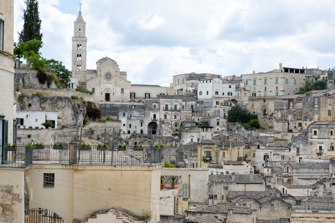
The sassi of Matera are the most internationally recognised expression of the rupestrian tradition — a UNESCO World Heritage Site since 1993 and the European Capital of Culture in 2019, visited now by millions of people who find in its cave-city drama a readier access to the Mediterranean past than most Italian hill towns provide. But the attention given to Matera has had the paradoxical effect of making the broader rupestrian landscape of Basilicata less visible by concentrating the tourist gaze on one celebrated instance of a phenomenon that extends for hundreds of kilometres through the region’s interior.
The territory around Matera — the Murgia plateau and the ravines of the Gravina di Matera and its tributaries — contains hundreds of rock-cut churches, cave dwellings, and underground cisterns that range in date from the early Christian period to the medieval. Most of them are not restored, not labelled, and not on any itinerary. They are simply there, in the landscape, accessible to those who know where to look and are willing to walk.
The Cave Churches of the Gravina
The churches cut into the walls of the Gravina di Matera and its satellite ravines represent a continuous tradition of sacred building that begins in the sixth century — when Byzantine monasticism brought to these remote gorges its characteristic preference for inaccessible places of prayer — and continues into the thirteenth, when the Norman and Swabian administrations gradually absorbed or replaced the Greek-rite communities that had maintained the rupestrian tradition.
The Byzantine fresco programmes that survive in the better-preserved cave churches are fragmentary but significant. The style that appears in cave after cave — the hieratic frontal figures, the gold-ground backgrounds, the inscriptions in Greek that identify the depicted saints — is recognisably related to the great Byzantine mosaic programmes of Sicily and of Constantinople, but translated into the humbler medium of lime plaster applied to damp stone, painted by craftsmen who were working from pattern books rather than from direct observation of metropolitan examples. Some cave churches contain fresco fragments of considerable refinement — faces modelled with genuine skill, drapery rendered with a sensitivity to the fall of light. Others contain rough outlines that suggest the desire for sacred imagery without the training to produce it. Both categories are moving, for reasons that have nothing to do with art-historical quality.
The Rupestrian Villages
Beyond Matera, the rupestrian tradition of Basilicata produced a series of villages whose medieval populations built and occupied cave complexes alongside the free-standing structures that developed on the plateau above the ravines. Several of these villages were subsequently abandoned — the population movements of the late medieval and early modern period, the malaria that made the low-lying ravine settlements dangerous, the attractions of the plateau — leaving rupestrian ghost communities whose empty chambers and carved cisterns are now the domain of researchers and the occasional visitor who finds them.
The village of Pisticci, in the clay badlands of the Basento valley, extends this tradition into a different geological context: the biancane — white clay formations sculpted by erosion into columns and pyramids — that characterise the Basilicatan interior south of Matera create a landscape that seems extraterrestrial and that the light of early morning and late afternoon transforms into something beyond dramatic. The towns built on the edges of these formations are themselves partially rupestrian, their foundations cut into the clay, their cisterns and storage chambers part of the geological fabric.
The Paths

The rupestrian landscape of Basilicata is most fully legible on foot. The ravine systems that define it are traversable by the network of paths that connected cave communities to each other and to the plateau above — paths that in some cases have been maintained and waymarked and in others require navigation by map and judgement. The walking is not technically demanding: the terrain, while steep in places, is not alpine, and the distances between significant sites are manageable. What the walking provides is the correct frame of reference: the experience of moving through the landscape at the pace at which it was originally traversed, of arriving at a cave church by the path that the monk who carved it also used, of understanding the relationship between the topography and the habitation as something bodily rather than merely visual.
The path from Matera’s Sasso Caveoso to the opposite wall of the Gravina — descending into the ravine, crossing the stream at the bottom, climbing the far face to the rupestrian complex on the opposite cliff — takes less than an hour. At the midpoint of the crossing, standing at the bottom of the gorge with the two faces of the city rising on either side, the scale of the rupestrian achievement becomes fully apparent: not the individual caves but the ensemble, the ravine city in its totality, the accumulated work of forty generations of stone-carving.
The Val d’Agri and the Southern Interior
The Val d’Agri, south of Matera toward the Calabrian border and the highland forests of the Sila plateau, represents the outer reach of the rupestrian zone. Here the landscape changes: the clay ravines give way to a broader valley surrounded by the limestone massifs of the southern Apennines, and the rupestrian tradition takes on a different character — less concentrated in the cliff-face settlements of the north, more dispersed through the woodland and pasture of a landscape that was primarily pastoral rather than agricultural.
The cave sanctuaries of the Val d’Agri are pilgrimage sites rather than monastic settlements: places associated with miraculous appearances, maintained by local communities whose relationship to them is devotional rather than scholarly. The images in these sanctuaries — usually a Madonna and Child in the Byzantine manner — are objects of continuous veneration that have never been classified as art and have accordingly been preserved in the conditions of use rather than the conditions of a museum.
What the Landscape Preserves
The rupestrian landscape of Basilicata is not, in the end, a collection of monuments. It is a record — inscribed in stone and clay — of the longest continuous experiment in human habitation that the Italian peninsula contains. The cave dwellers of the Gravina occupied the same ravines as the first prehistoric settlers of the region; the Byzantine monks who carved their oratories into the same stone were working in a tradition of rupestrian sacred space that predated Christianity; the medieval peasant communities that maintained the cave churches while building free-standing houses on the plateau above preserved them through a combination of devotion and conservatism that no heritage institution has since equalled.
To walk through this landscape is to encounter that continuity in its unmediated form: present in the material reality of carved stone and painted plaster that has survived, more or less intact, because the landscape in which it sits was too poor and too remote to attract the attention that would have destroyed it. That poverty was, for once, a form of protection. The same interior is now the territory of the rewilding programmes reshaping Basilicata’s highland economy, where the recovery of the natural landscape and the recovery of the historical one proceed in parallel.

