Above the Traffic
The volcanic plateau of southern Lazio — the territory that extends northwest of Rome between the Bracciano lake and the Viterbo hills, crossed by the ancient roads that connected the Roman capital to its Etruscan predecessors — is one of the most archaeologically dense landscapes in Italy and one of the least visited by the tourists who fill the Roman monuments to capacity in every season. The Etruscans, whose civilisation occupied this territory from the eighth century BCE until its absorption into the Roman Republic in the third, left a physical record in the landscape that ranges from the spectacular — the necropolis cities of Cerveteri and Tarquinia, with their painted tombs — to the almost invisible: the road cuts through the volcanic tufa that persist in the landscape as negative forms, the Etruscan hollows whose purpose is still debated, the field systems whose boundaries have survived two and a half thousand years of subsequent agricultural activity.
The plateau itself is the geological foundation of everything that followed: the volcanic activity of the Pleistocene that produced the tufa from which the Etruscans built and carved, the rivers that cut through it to create the dramatic gorges whose cliff faces the Etruscans used for their tombs, the lakes that filled the old volcanic craters and that still define the landscape between Bolsena and Bracciano. It is a landscape formed by forces considerably older than the human history inscribed in it, and understanding the geology is the beginning of understanding everything else.
The Etruscan Road Network
The Etruscan civilisation of the southern Lazio plateau was, among other things, a road-building civilisation: the network of roads that connected the principal Etruscan cities — Cerveteri (Caere), Tarquinia, Veii, Vulci — to each other and to the ports of the Tyrrhenian coast was one of the most sophisticated in pre-Roman Italy, and its engineering has proved remarkably durable. The Roman road system that overlaid and in many cases replaced it used the same topographic logic — the ridgeway route that followed the plateau edge, the valley road that served the agricultural settlements below — and in some cases literally followed the same alignment.
The Etruscan roads that survive in their unmodified form are among the most extraordinary features of the southern Lazio landscape. Cut into the tufa in the same way as the tomb facades — the rock removed to create a sunken road whose walls rise on both sides to heights of several metres — they are known locally as vie cave, hollow ways. The most famous are in the territory of Pitigliano and Sorano, in the extreme southern edge of the Lazio tufa zone, but the distribution is much wider: hollow ways cut by Etruscan, or possibly pre-Etruscan, communities appear across the entire plateau, connecting tomb sites, sacred springs, and agricultural settlements in a network that the Roman roads subsequently rationalised without entirely replacing.
The Necropolis as Urban Form
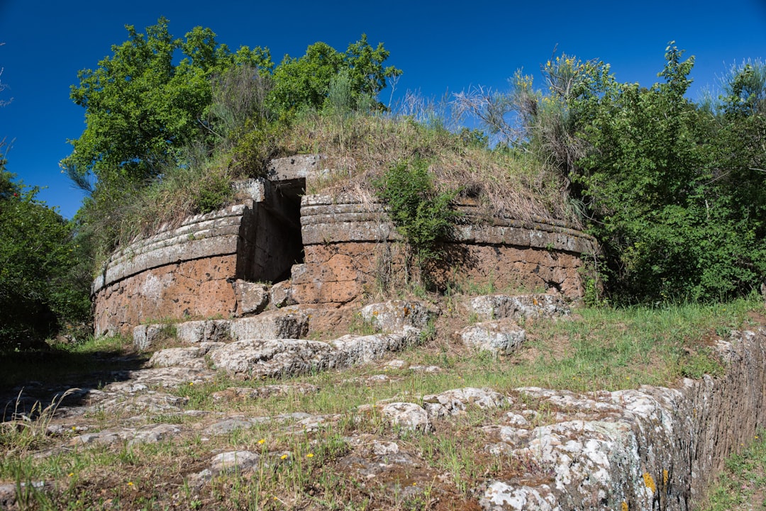
The Etruscan necropolis is not simply a cemetery. It is a city — a city of the dead, built with the same urban intelligence as the city of the living, whose streets and houses and public spaces are organised around the same principles of community and spatial hierarchy that structured Etruscan urbanism. The necropolis of Cerveteri, the Banditaccia, is the most extensive surviving example: hundreds of tumulus tombs, cut from the tufa or built above it, whose interior chambers reproduce the architectural features of Etruscan domestic space with a completeness that the domestic architecture of the living, built in perishable materials, did not survive to demonstrate.
Walking through the Banditaccia — and it is a walking experience, covering a site whose area is too large to be absorbed from any fixed viewpoint — is an experience of urban space rather than of scattered monuments. The paths between the tumuli are the streets of the necropolis city; the larger tumuli that front on the main axis are the equivalent of the public buildings that marked the principal streets of the living city. The topographic intelligence with which the site was laid out — the use of the ridge above the river gorge, the organisation of the different phases of the necropolis’s development in distinguishable zones — is the intelligence of urban planners rather than simple gravediggers.
Tarquinia and the Painted Tombs
The painted tombs of Tarquinia — the Monterozzi necropolis, whose cliff-face location above the Marta valley gives it a topographic drama that the flat terrain of Cerveteri does not provide — constitute the most significant surviving body of Etruscan painting and one of the most significant bodies of ancient painting of any culture. The images they contain — banquets, athletic competitions, hunting and fishing scenes, dances, mythological narratives, and, in the later tombs, scenes of the underworld — are primary documents of Etruscan life and Etruscan belief, made more vivid by the fact that no equivalent body of Etruscan literary evidence survives to interpret them.
The conditions in which the paintings have survived are the conditions of their creation: the sealed, humidity-controlled tomb chambers whose atmospheric stability allowed pigments to remain fresh for two and a half thousand years. The conditions in which they are now visited — limited-access groups, timed entry, strict no-touch protocols — are the conditions of their conservation. The best-preserved tombs are accessible to visitors in small groups at controlled intervals; the experience of standing in a tomb chamber of five metres by three, in the presence of paintings that are simultaneously ancient and immediate, is one of the most concentrated encounters with the past that the Italian landscape provides.
The Plateau Today

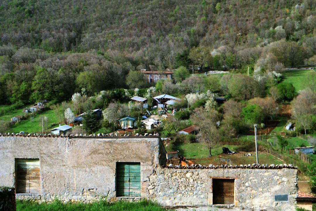
The tufa plateau north of Rome is not a preserved archaeological landscape in any comprehensive sense. It is a working landscape: the same terrain that the Etruscans inhabited is now producing wine, olive oil, and the Lazio sheep’s milk cheese that the shepherds of the plateau have been making since before the Roman period. The baroque hill towns of the Lazio interior — several of them built directly on Etruscan foundations, their cathedral crypts cut into the same tufa as the tomb chambers below — are the most recent architectural layer on a landscape that has been continuously inhabited for three thousand years. The Etruscan material is woven into this working landscape rather than separated from it: the tomb facade that appears at the edge of a vineyard, the hollow way that a farm track follows for half its length before diverging, the tufa quarry that is still producing building stone from the same formation that the Etruscan mason worked two thousand years ago.
This integration of the archaeological and the agricultural — the fact that the landscape contains both the ancient material and the living activity without separating them into designated zones — is the most distinctive quality of the southern Lazio plateau as a travel destination. It is a landscape in which the Etruscan past is one layer among several, visible to those who know how to read it and requiring time and some background from those who do not. The investment is proportionate to the return: a landscape that reveals itself differently on the third visit from the first, and that continues to produce new readings as long as you continue to look. The plateau is accessible from Rome by regional train to Viterbo or Civitavecchia, with onward connections to several of the principal Etruscan sites, making a day visit without a car a practical option for those based in the capital.